
Wommelgem topographic map
Interactive map
Click on the map to display elevation.
About this map
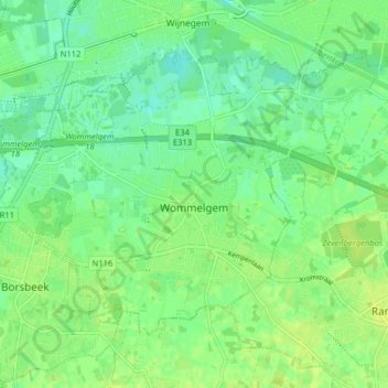
Name: Wommelgem topographic map, elevation, terrain.
Location: Wommelgem, Antwerp, Flanders, 2160, Belgium (51.18662 4.48230 51.22300 4.56228)
Average elevation: 9 m
Minimum elevation: 1 m
Maximum elevation: 14 m
Other topographic maps
Click on a map to view its topography, its elevation and its terrain.