
Berg en Terblijt topographic map
Interactive map
Click on the map to display elevation.
About this map
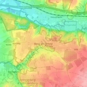
Name: Berg en Terblijt topographic map, elevation, terrain.
Location: Berg en Terblijt, Limburg, Nederland, 6325, Nederland (50.84036 5.76587 50.88036 5.80587)
Average elevation: 104 m
Minimum elevation: 48 m
Maximum elevation: 161 m
Other topographic maps
Click on a map to view its topography, its elevation and its terrain.
Geulhem
Nederland > Limburg > Berg en Terblijt
Geulhem, Berg en Terblijt, Valkenburg aan de Geul, Limburg, Nederland, 6325 PJ, Nederland
Average elevation: 100 m