
Brighton topographic map
Interactive map
Click on the map to display elevation.
About this map
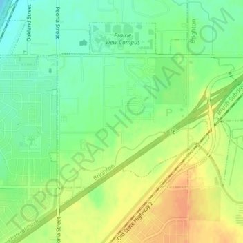
Name: Brighton topographic map, elevation, terrain.
Location: Brighton, Adams County, Colorado, United States (39.89962 -104.84671 39.91440 -104.81885)
Average elevation: 1,551 m
Minimum elevation: 1,533 m
Maximum elevation: 1,569 m