
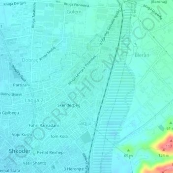
Lagjja 3 topographic map
Interactive map
Click on the map to display elevation.
About this map
Name: Lagjja 3 topographic map, elevation, terrain.
Average elevation: 24 m
Minimum elevation: 10 m
Maximum elevation: 116 m
Other topographic maps
Click on a map to view its topography, its elevation and its terrain.
Shkoder
Albania > Northern Albania > Shkoder
Shkoder, Shkodër Municipality, Shkodër County, Northern Albania, 4001-4007, Albania
Average elevation: 47 m