
Lake Louise topographic map
Interactive map
Click on the map to display elevation.
About this map
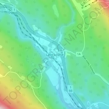
Name: Lake Louise topographic map, elevation, terrain.
Location: Lake Louise, Alberta, Canada (51.40497 -116.19754 51.44497 -116.15754)
Average elevation: 1,617 m
Minimum elevation: 1,518 m
Maximum elevation: 1,934 m