
Lorentzweiler topographic map
Interactive map
Click on the map to display elevation.
About this map
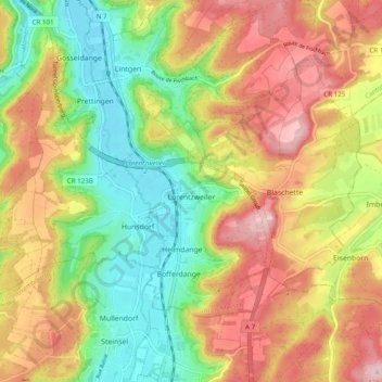
Name: Lorentzweiler topographic map, elevation, terrain.
Location: Lorentzweiler, Canton Mersch, Luxembourg (49.68134 6.09015 49.72304 6.18723)
Average elevation: 323 m
Minimum elevation: 217 m
Maximum elevation: 440 m