
Thank you for supporting this site ❤️
Make a donation
Make a donation
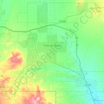
Prescott Valley topographic map
Click on the map to display elevation.
Thank you for supporting this site ❤️
Make a donation
Make a donation
Prescott Valley
Prescott Valley (locally, PV) is located in central Arizona approximately 85 miles (137 km) north of Phoenix at 5,100 feet (1,600 m). elevation. PV has good access to Arizona State Route 89, SR-89A and SR-69, connecting to Interstates 17 and 40. Air service is available at Ernest A. Love Field, about 8 miles (13 km) northwest.
Thank you for supporting this site ❤️
Make a donation
Make a donation
About this map
Name: Prescott Valley topographic map, elevation, terrain.
Average elevation: 1,550 m
Minimum elevation: 1,378 m
Maximum elevation: 1,972 m
Thank you for supporting this site ❤️
Make a donation
Make a donation