
Lummen topographic map
Interactive map
Click on the map to display elevation.
About this map
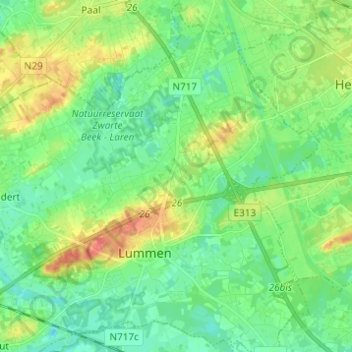
Name: Lummen topographic map, elevation, terrain.
Location: Lummen, Hasselt, Limburg, Vlaanderen, 3560, België (50.96419 5.13014 51.04144 5.25272)
Average elevation: 31 m
Minimum elevation: 14 m
Maximum elevation: 65 m
Other topographic maps
Click on a map to view its topography, its elevation and its terrain.
Thiewinkel
België > Limburg > Hasselt > Lummen
Thiewinkel, Lummen, Hasselt, Limburg, Vlaanderen, 3560, België
Average elevation: 26 m