
Galmaarden topographic map
Interactive map
Click on the map to display elevation.
About this map
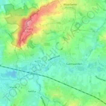
Name: Galmaarden topographic map, elevation, terrain.
Location: Galmaarden, Halle-Vilvoorde, Vlaams-Brabant, Vlaanderen, België (50.73482 3.93104 50.77972 3.98624)
Average elevation: 42 m
Minimum elevation: 12 m
Maximum elevation: 108 m
Other topographic maps
Click on a map to view its topography, its elevation and its terrain.
Kluysbos
België > Vlaams-Brabant > Halle-Vilvoorde > Galmaarden > Sint-Paulus
Kluysbos, Boschveldweg, Sint-Paulus, Galmaarden, Halle-Vilvoorde, Vlaams-Brabant, Vlaanderen, 1570, België
Average elevation: 49 m
Congoberg
België > Vlaams-Brabant > Halle-Vilvoorde > Galmaarden
Congoberg, Galmaarden, Halle-Vilvoorde, Vlaams-Brabant, Vlaanderen, 1570, België
Average elevation: 53 m