
Keerbergen topographic map
Interactive map
Click on the map to display elevation.
About this map
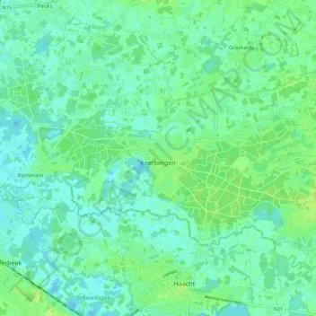
Name: Keerbergen topographic map, elevation, terrain.
Location: Keerbergen, Leuven, Flemish Brabant, Flanders, 3140, Belgium (50.98538 4.59854 51.02403 4.70949)
Average elevation: 8 m
Minimum elevation: 3 m
Maximum elevation: 15 m
Other topographic maps
Click on a map to view its topography, its elevation and its terrain.