
Ramalde topographic map
Interactive map
Click on the map to display elevation.
About this map
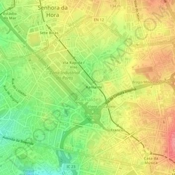
Name: Ramalde topographic map, elevation, terrain.
Location: Ramalde, Porto, Portugal (41.15976 -8.66300 41.18433 -8.62268)
Average elevation: 79 m
Minimum elevation: 35 m
Maximum elevation: 118 m
Other topographic maps
Click on a map to view its topography, its elevation and its terrain.