
Sint-Niklaas topographic map
Interactive map
Click on the map to display elevation.
About this map
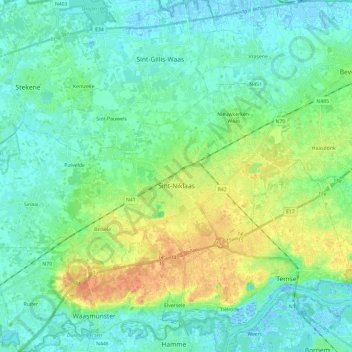
Name: Sint-Niklaas topographic map, elevation, terrain.
Location: Sint-Niklaas, East Flanders, Flanders, Belgium (51.12959 3.98531 51.20781 4.22170)
Average elevation: 10 m
Minimum elevation: -3 m
Maximum elevation: 33 m
Other topographic maps
Click on a map to view its topography, its elevation and its terrain.