
Maun topographic map
Interactive map
Click on the map to display elevation.
About this map
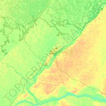
Name: Maun topographic map, elevation, terrain.
Location: Maun, North-West District, Botswana (-20.14610 23.26244 -19.82610 23.58244)
Average elevation: 942 m
Minimum elevation: 929 m
Maximum elevation: 954 m
Other topographic maps
Click on a map to view its topography, its elevation and its terrain.
Shashe river
Botswana > North-West District > Maun
Shashe river, Maun, North-West District, P.O. BOX 217, Botswana
Average elevation: 941 m
Thamalakane River
Botswana > North-West District > Maun
Thamalakane River, Maun, North-West District, P.O. BOX 217, Botswana
Average elevation: 942 m