
Jork topographic map
Interactive map
Click on the map to display elevation.
About this map
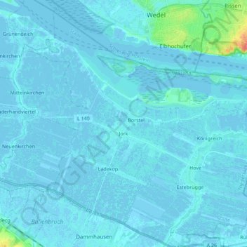
Name: Jork topographic map, elevation, terrain.
Location: Jork, Stade, Niedersachsen, 21635, Deutschland (53.49079 9.61231 53.58249 9.78129)
Average elevation: 3 m
Minimum elevation: -3 m
Maximum elevation: 52 m