
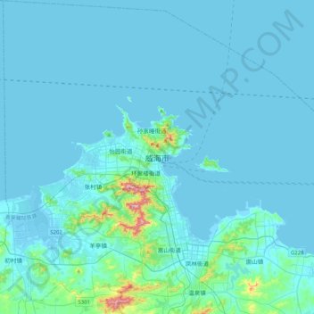
威海市 topographic map
Interactive map
Click on the map to display elevation.
About this map
Name: 威海市 topographic map, elevation, terrain.
Location: 威海市, 环翠区, 威海市, 山东省, 264200, 中国 (37.35210 121.95526 37.67210 122.27526)
Average elevation: 25 m
Minimum elevation: -3 m
Maximum elevation: 402 m
威海市是中华人民共和国山东省下辖的地级市,位于山东省东部。市境除西面与烟台市接壤外,北东南三面皆濒临黄海,北与辽东半岛相对,东与朝鲜半岛相望。地处山东半岛最东端,鲁东丘陵区东部,地形以低山丘陵为主。境内河流属山东沿海诸河水系,北流入海的有初村河、羊亭河、五渚河等,南流入海的有沽河、母猪河、黄垒河、乳山河等。海岸线曲折,岛礁众多,有刘公岛、鸡鸣岛、镆铘岛等岛屿,沿岸并有多个海湾。全市总面积5,797平方公里,人口282.56万,市人民政府驻环翠区。
Other topographic maps
Click on a map to view its topography, its elevation and its terrain.