
Khulna Division topographic map
Interactive map
Click on the map to display elevation.
About this map
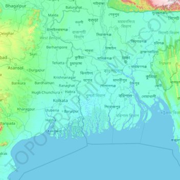
Name: Khulna Division topographic map, elevation, terrain.
Location: Khulna Division, Bangladesh (20.37721 86.72527 25.49721 91.84527)
Average elevation: 40 m
Minimum elevation: -3 m
Maximum elevation: 1,913 m