
Haferungen topographic map
Interactive map
Click on the map to display elevation.
About this map
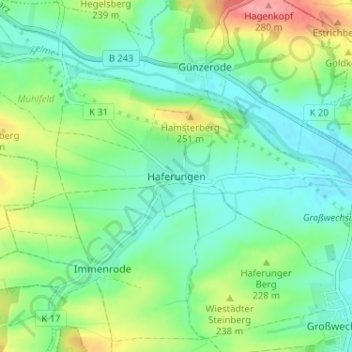
Name: Haferungen topographic map, elevation, terrain.
Location: Haferungen, Landkreis Nordhausen, Thüringen, Deutschland (51.48940 10.63898 51.52940 10.67898)
Average elevation: 218 m
Minimum elevation: 190 m
Maximum elevation: 281 m