
江苏省 topographic map
Interactive map
Click on the map to display elevation.
About this map
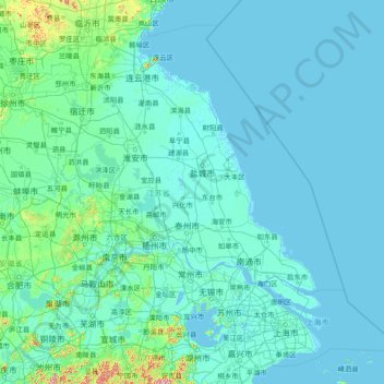
Name: 江苏省 topographic map, elevation, terrain.
Location: 江苏省, 中国 (30.76033 116.35520 35.16667 122.38666)
Average elevation: 24 m
Minimum elevation: -3 m
Maximum elevation: 1,144 m
连云港境内的花果山玉女峰为全省最高点,海拔624.4米。
Other topographic maps
Click on a map to view its topography, its elevation and its terrain.