
Ashgabat topographic map
Interactive map
Click on the map to display elevation.
About this map
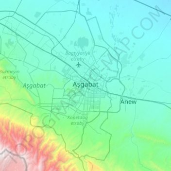
Name: Ashgabat topographic map, elevation, terrain.
Location: Ashgabat, Turkmenistan (37.77061 57.99227 38.10538 58.47864)
Average elevation: 718 m
Minimum elevation: 133 m
Maximum elevation: 2,951 m