
Thimphu topographic map
Interactive map
Click on the map to display elevation.
Thimphu
The Raidāk River raises in the snow fields at an altitude of about 7,000 metres (23,000 ft). It has many tributaries that flow from the Himalayan peaks that largely dictate the topography of the Thimphu valley. The Thimphu valley, so formed, is delimited by a steep eastern ridge that rises from the riverbed and a valley formation with gradually sloping topography, extending from Dechencholing and Simtokha, on the western banks of the Raidāk. The north-south orientation of the hill ranges of the valley means that they are exposed to moist monsoon winds which engulf the inner Himalayas and its lower valleys. However, the windward and leeward sides of the hill ranges have different vegetation patterns depending on the varying rainfall incidence in the two sides. Thimphu valley lying in the leeward side of the mountains is comparatively dry and contains a different type of vegetation as compared to the windward side. Hence, the coniferous vegetation in the valley is attributed to this phenomenon. Punakha, the old capital of Bhutan, is on the windward side with broad-leaved trees dominating the topography.
About this map
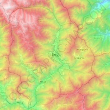
Name: Thimphu topographic map, elevation, terrain.
Location: Thimphu, Thimphu District, 10011, Bhutan (27.31276 89.46955 27.63276 89.78955)
Average elevation: 3,127 m
Minimum elevation: 1,324 m
Maximum elevation: 5,094 m