
Deoghar topographic map
Interactive map
Click on the map to display elevation.
About this map
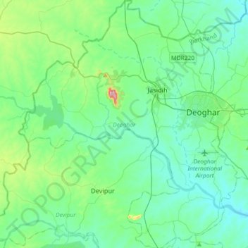
Name: Deoghar topographic map, elevation, terrain.
Location: Deoghar, Jharkhand, 814112, India (24.34495 86.48309 24.60863 86.74766)
Average elevation: 258 m
Minimum elevation: 203 m
Maximum elevation: 519 m