
Chittaranjan topographic map
Interactive map
Click on the map to display elevation.
Chittaranjan
Chittaranjan is located at 23°52′N 86°52′E / 23.87°N 86.87°E / 23.87; 86.87. It has an average elevation of 155 metres (508 feet).
About this map
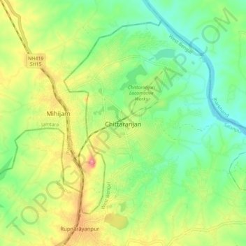
Name: Chittaranjan topographic map, elevation, terrain.
Average elevation: 156 m
Minimum elevation: 115 m
Maximum elevation: 219 m