
Georgetown topographic map
Interactive map
Click on the map to display elevation.
About this map
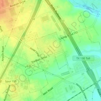
Name: Georgetown topographic map, elevation, terrain.
Location: Georgetown, Williamson County, Texas, United States (30.66650 -97.66000 30.67646 -97.64954)
Average elevation: 219 m
Minimum elevation: 200 m
Maximum elevation: 236 m
The city is located on the northeastern edge of Texas Hill Country. Portions of Georgetown are located on either side of the Balcones Escarpment, a fault line in which the areas roughly east of IH-35 are flat and characterized by having black, fertile soils of the Blackland Prairie, and the west side of the escarpment which consists mostly of hilly, karst-like terrain with little topsoil and higher elevations and which is part of the Texas Hill Country. Inner Space Cavern, a large cave, is a major tourist attraction found on the south side of the city, just west of Interstate 35, and is a large-scale example of limestone karst formations.