
Nanning City topographic map
Interactive map
Click on the map to display elevation.
About this map
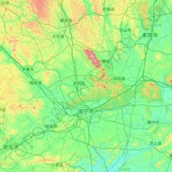
Name: Nanning City topographic map, elevation, terrain.
Location: Nanning City, Guangxi, China (22.20440 107.32990 24.03392 109.61326)
Average elevation: 229 m
Minimum elevation: 10 m
Maximum elevation: 1,721 m
Other topographic maps
Click on a map to view its topography, its elevation and its terrain.