
Tshopo topographic map
Interactive map
Click on the map to display elevation.
About this map
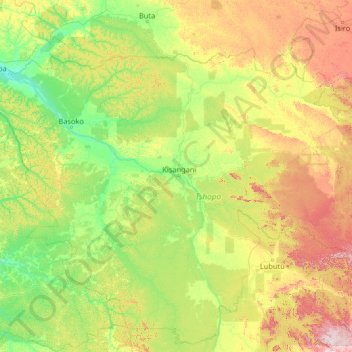
Name: Tshopo topographic map, elevation, terrain.
Location: Tshopo, Democratic Republic of the Congo (-2.10085 22.56512 3.09915 27.76512)
Average elevation: 516 m
Minimum elevation: 351 m
Maximum elevation: 1,325 m
Other topographic maps
Click on a map to view its topography, its elevation and its terrain.