
Ganderbal topographic map
Interactive map
Click on the map to display elevation.
About this map
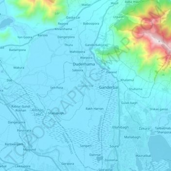
Name: Ganderbal topographic map, elevation, terrain.
Location: Ganderbal, Jammu and Kashmir, India (34.11255 74.71491 34.27296 74.93139)
Average elevation: 1,885 m
Minimum elevation: 1,580 m
Maximum elevation: 3,443 m
Other topographic maps
Click on a map to view its topography, its elevation and its terrain.