
Lake Harris topographic map
Interactive map
Click on the map to display elevation.
About this map
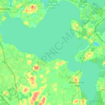
Name: Lake Harris topographic map, elevation, terrain.
Average elevation: 25 m
Minimum elevation: 11 m
Maximum elevation: 59 m
Lake Harris' depth is much greater than Lake Okeechobee to the south, with many deeper holes and ledges. The lake is surrounded by sandhills and cypress trees, part of the Central Florida Ridge. This region has the highest elevations in central Florida, reaching 312 feet (95 m) above sea level. Compared to the rest of Florida, which is relatively flat, it is quite hilly.