
Ituri topographic map
Interactive map
Click on the map to display elevation.
About this map
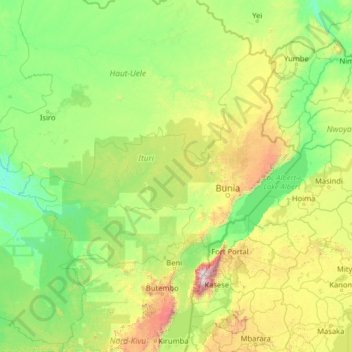
Name: Ituri topographic map, elevation, terrain.
Location: Ituri, Democratic Republic of the Congo (-0.72694 26.93808 4.39306 32.05808)
Average elevation: 952 m
Minimum elevation: 487 m
Maximum elevation: 4,622 m