
Brakel topographic map
Interactive map
Click on the map to display elevation.
About this map
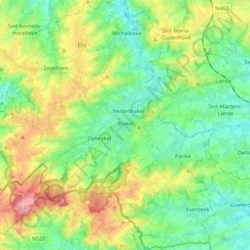
Name: Brakel topographic map, elevation, terrain.
Location: Brakel, East Flanders, Flanders, Belgium (50.74744 3.69917 50.84727 3.81992)
Average elevation: 69 m
Minimum elevation: 22 m
Maximum elevation: 161 m