
Camp Citron topographic map
Interactive map
Click on the map to display elevation.
About this map
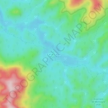
Name: Camp Citron topographic map, elevation, terrain.
Location: Camp Citron, Saint-Laurent-du-Maroni, Guyane, France (4.71693 -53.97996 4.75693 -53.93996)
Average elevation: 140 m
Minimum elevation: 61 m
Maximum elevation: 359 m