
Baw Baw National Park topographic map
Interactive map
Click on the map to display elevation.
About this map
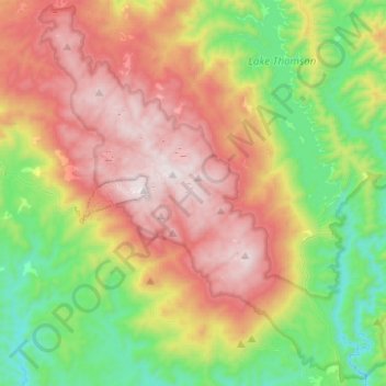
Name: Baw Baw National Park topographic map, elevation, terrain.
Average elevation: 800 m
Minimum elevation: 226 m
Maximum elevation: 1,554 m
Other topographic maps
Click on a map to view its topography, its elevation and its terrain.
Baw Baw Village
Australia > Victoria > Mount Baw Baw Alpine Resort
Baw Baw Village, Mount Baw Baw Alpine Resort, Shire of Baw Baw, Victoria, Australia
Average elevation: 1,205 m
Mount Baw Baw Alpine Resort
Australia > Victoria > Mount Baw Baw Alpine Resort
Mount Baw Baw Alpine Resort, Victoria, Australia
Average elevation: 1,298 m