
Loksbergen topographic map
Interactive map
Click on the map to display elevation.
About this map
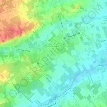
Name: Loksbergen topographic map, elevation, terrain.
Location: Loksbergen, Halen, Hasselt, Limburg, België (50.91633 5.04387 50.94765 5.09200)
Average elevation: 42 m
Minimum elevation: 22 m
Maximum elevation: 82 m
Other topographic maps
Click on a map to view its topography, its elevation and its terrain.