
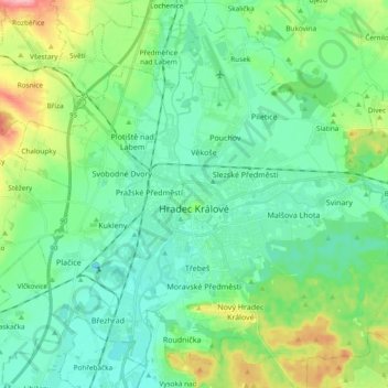
Hradec Králové topographic map
Interactive map
Click on the map to display elevation.
About this map
Name: Hradec Králové topographic map, elevation, terrain.
Average elevation: 248 m
Minimum elevation: 218 m
Maximum elevation: 332 m
Hradec Králové lies at the confluence of the Elbe and the Orlice rivers. It is located in the East Elbe Table, in the eastern part of the Polabí lowlands. The municipal territory is rich in small fish ponds. The highest point is the hill Slatina with an elevation of 281 metres (922 ft).