
Rio Amapari topographic map
Interactive map
Click on the map to display elevation.
About this map
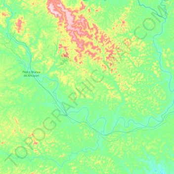
Name: Rio Amapari topographic map, elevation, terrain.
Average elevation: 121 m
Minimum elevation: 28 m
Maximum elevation: 377 m
Other topographic maps
Click on a map to view its topography, its elevation and its terrain.
Porto Grande
Brasil > Amapá > Porto Grande
Porto Grande, Microrregião de Macapá, Mesorregião Sul do Amapá, Amapá, Região Norte, 68997000, Brasil
Average elevation: 101 m