
Summerlin topographic map
Interactive map
Click on the map to display elevation.
About this map
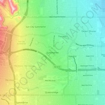
Name: Summerlin topographic map, elevation, terrain.
Average elevation: 843 m
Minimum elevation: 706 m
Maximum elevation: 1,146 m
Other topographic maps
Click on a map to view its topography, its elevation and its terrain.
Majestic Park
United States > Nevada > Clark County > Las Vegas
Majestic Park, Lone Mountain, Las Vegas, Clark County, Nevada, United States
Average elevation: 820 m