
Marietta topographic map
Interactive map
Click on the map to display elevation.
About this map
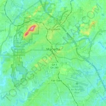
Name: Marietta topographic map, elevation, terrain.
Location: Marietta, Cobb County, Georgia, United States (33.89559 -84.61681 34.00117 -84.46794)
Average elevation: 323 m
Minimum elevation: 274 m
Maximum elevation: 532 m
Other topographic maps
Click on a map to view its topography, its elevation and its terrain.
Kennesaw
United States > Georgia > Cobb County
Kennesaw, Cobb County, Georgia, United States
Average elevation: 317 m