Geolocate

Tezpur topographic map

Interactive map

Click on the map to display elevation.

About this map

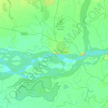
Name: Tezpur topographic map, elevation, terrain.

Location: Tezpur, Sonitpur, Assam, India (26.50633 92.57878 26.72748 92.93493)

Average elevation: 68 m

Minimum elevation: 53 m

Maximum elevation: 140 m

Other topographic maps

Click on a map to view its topography, its elevation and its terrain.

Dispur

India > Assam

Dispur, Kamrup Metropolitan, Assam, India

Average elevation: 95 m

Titabor

India > Assam > Titabor

Titabor, Jorhat, Assam, 785630, India

Average elevation: 97 m

Jorhat

India > Assam > Jorhat

Jorhat, Jorhat East, Jorhat, Assam, 785001, India

Average elevation: 93 m

Sibsagar

India > Assam

Sibsagar, Sivasagar, Assam, India

Average elevation: 94 m

Majuli

India > Assam

Majuli, Assam, 785104, India

Average elevation: 90 m