
Kalimpong topographic map
Interactive map
Click on the map to display elevation.
Kalimpong
Kalimpong is a city and a municipality in the Indian state of West Bengal. It is located at an average elevation of 1,250 metres (4,101 ft). The city is the headquarters of the Kalimpong district. Kalimpong district region comes under Gorkhaland Territorial Administration which is an autonomous governing body within the state of West Bengal. The Indian Army's 27 Mountain Division is located on the outskirts of the city.
About this map
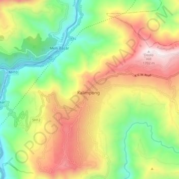
Name: Kalimpong topographic map, elevation, terrain.
Location: Kalimpong, Kalimpong -I, Kalimpong, West Bengal, 734301, India (27.03169 88.43290 27.11169 88.51290)
Average elevation: 838 m
Minimum elevation: 196 m
Maximum elevation: 1,683 m