
Darjeeling topographic map
Interactive map
Click on the map to display elevation.
Darjeeling
Darjeeling (Bengali: , Nepali: ) is a city and a municipality in the Indian state of West Bengal. It is located in the Lesser Himalayas at an elevation of 2,000 metres (6,700 ft). It is noted for its tea industry, its views of Kangchenjunga, the world's third-highest mountain, and the Darjeeling Himalayan Railway, a UNESCO World Heritage Site. Darjeeling is the headquarters of the Darjeeling district which has a partially autonomous status called Gorkhaland Territorial Administration within the state of West Bengal. It is also a popular tourist destination in India.
About this map
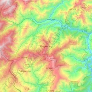
Name: Darjeeling topographic map, elevation, terrain.
Average elevation: 1,331 m
Minimum elevation: 165 m
Maximum elevation: 3,066 m