
Cedar Creek topographic map
Interactive map
Click on the map to display elevation.
About this map
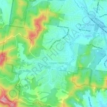
Name: Cedar Creek topographic map, elevation, terrain.
Location: Cedar Creek, Brisbane, Queensland, 4055, Australia (-27.42500 152.89579 -27.40336 152.94077)
Average elevation: 105 m
Minimum elevation: 53 m
Maximum elevation: 236 m
Other topographic maps
Click on a map to view its topography, its elevation and its terrain.