
Make a donation
San Francisco Bay Area topographic map
Click on the map to display elevation.
Make a donation
San Francisco Bay Area
The San Francisco Bay Area is characterized by a diverse and dynamic topography shaped by geological processes over millions of years. This region features a combination of coastal plains, steep hills, and rugged mountains, all influenced by the tectonic activity associated with the nearby San Andreas Fault and other fault systems. The Pacific Coast Range, which includes the Santa Cruz Mountains and the Marin Hills, runs parallel to the coastline, contributing to the area's vertical relief. The highest peaks, such as Mount Diablo and Mission Peak, rise sharply, creating dramatic vistas. The bay itself is bordered by a variety of landforms, including marshes, alluvial plains, and cliff-lined shores, reflecting both the natural erosion processes and the impacts of urbanization.
Make a donation
About this map
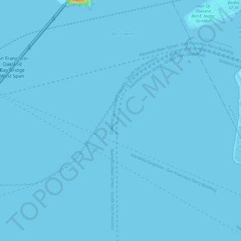
Name: San Francisco Bay Area topographic map, elevation, terrain.
Average elevation: 113 m
Minimum elevation: -7 m
Maximum elevation: 1,296 m
Make a donation
Other topographic maps
Click on a map to view its topography, its elevation and its terrain.
Golden Gate Park
United States > California > San Francisco
Conceived ostensibly for recreation, the underlying purpose of the park was housing development and the westward expansion of the city. Field engineer William Hammond Hall prepared a survey and topographic map of the park site in 1870 and became its commissioner in 1871. He was later named California's first…
Average elevation: 71 m
Golden Gate Park
United States > California > San Francisco
In the 1860s, San Franciscans began to feel the need for a spacious public park similar to Central Park, which was then taking shape in New York City. Golden Gate Park was carved out of unpromising sand and shore dunes that were known as the Outside Lands, in an unincorporated area west of San Francisco's…
Average elevation: 71 m
Make a donation
Make a donation
Make a donation
San Francisco Maritime National Historical Park
United States > California > San Francisco
Average elevation: 11 m
Make a donation
Make a donation