
Big Springs topographic map
Interactive map
Click on the map to display elevation.
About this map
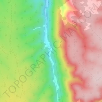
Name: Big Springs topographic map, elevation, terrain.
Average elevation: 2,278 m
Minimum elevation: 2,102 m
Maximum elevation: 2,418 m
Other topographic maps
Click on a map to view its topography, its elevation and its terrain.
Prescott Valley
United States of America > Arizona > Prescott Valley
Prescott Valley (locally, PV) is located in central Arizona approximately 85 miles (137 km) north of Phoenix at 5,100 feet (1,600 m). elevation. PV has good access to Arizona State Route 89, SR-89A and SR-69, connecting to Interstates 17 and 40. Air service is available at Ernest A. Love Field, about 8 miles…
Average elevation: 1,550 m
Prescott
United States of America > Arizona > Prescott
Prescott is in the Bradshaw Mountains of central Arizona, at an elevation of 5,400 feet (1,600 m). The city has a Mediterranean climate (Köppen Csa); however, unlike most other locations in this climate class, there is a pronounced summer wet season due to the North American Monsoon.
Average elevation: 1,674 m