
Brown Lake topographic map
Interactive map
Click on the map to display elevation.
About this map
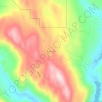
Name: Brown Lake topographic map, elevation, terrain.
Average elevation: 719 m
Minimum elevation: 472 m
Maximum elevation: 970 m
Other topographic maps
Click on a map to view its topography, its elevation and its terrain.
Green Lake
United States of America > Washington > Okanogan County > Brown Lake
Green Lake, Green Lake Road, Brown Lake, Okanogan County, Washington, United States of America
Average elevation: 678 m