
Thank you for supporting this site ❤️
Make a donation
Make a donation
Ozona topographic map
Click on the map to display elevation.
Thank you for supporting this site ❤️
Make a donation
Make a donation
About this map
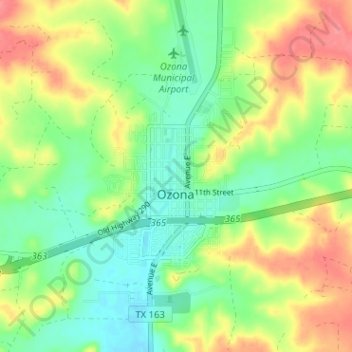
Name: Ozona topographic map, elevation, terrain.
Location: Ozona, Crockett County, Texas, 76943, United States (30.68989 -101.23682 30.73562 -101.17330)
Average elevation: 735 m
Minimum elevation: 706 m
Maximum elevation: 774 m
Thank you for supporting this site ❤️
Make a donation
Make a donation
Other topographic maps
Click on a map to view its topography, its elevation and its terrain.