Saint-Lary-Soulan topographic map
Interactive map
Click on the map to display elevation.
About this map
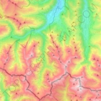
Name: Saint-Lary-Soulan topographic map, elevation, terrain.
Average elevation: 1,864 m
Minimum elevation: 757 m
Maximum elevation: 3,147 m

Click on the map to display elevation.
Name: Saint-Lary-Soulan topographic map, elevation, terrain.
Average elevation: 1,864 m
Minimum elevation: 757 m
Maximum elevation: 3,147 m