
Kota Tinggi topographic map
Interactive map
Click on the map to display elevation.
About this map
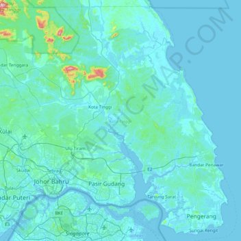
Name: Kota Tinggi topographic map, elevation, terrain.
Location: Kota Tinggi, Johor, Malaysia (1.33682 103.55108 2.04543 104.29836)
Average elevation: 29 m
Minimum elevation: -5 m
Maximum elevation: 623 m
Other topographic maps
Click on a map to view its topography, its elevation and its terrain.