
Perry County topographic map
Interactive map
Click on the map to display elevation.
About this map
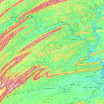
Name: Perry County topographic map, elevation, terrain.
Location: Perry County, Pennsylvania, United States (40.18553 -77.67181 40.62842 -76.91219)
Average elevation: 237 m
Minimum elevation: 88 m
Maximum elevation: 689 m