
Kendrick topographic map
Interactive map
Click on the map to display elevation.
About this map
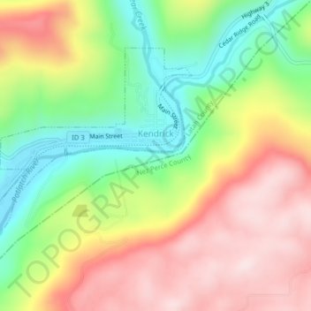
Name: Kendrick topographic map, elevation, terrain.
Average elevation: 559 m
Minimum elevation: 354 m
Maximum elevation: 773 m
Kendrick is located at 46°36′52″N 116°39′1″W / 46.61444°N 116.65028°W / 46.61444; -116.65028 (46.614321, -116.650354), near the Potlatch River. The elevation of the city is 1,240 feet (378 m) above sea level.