
Yelm topographic map
Interactive map
Click on the map to display elevation.
About this map
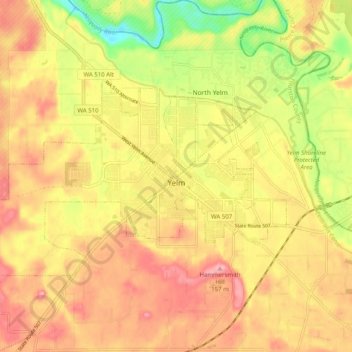
Name: Yelm topographic map, elevation, terrain.
Location: Yelm, Thurston County, Washington, United States (46.92338 -122.67507 46.96201 -122.57511)
Average elevation: 107 m
Minimum elevation: 35 m
Maximum elevation: 156 m
Other topographic maps
Click on a map to view its topography, its elevation and its terrain.