
Troy topographic map
Interactive map
Click on the map to display elevation.
About this map
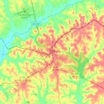
Name: Troy topographic map, elevation, terrain.
Location: Troy, Pike County, Alabama, United States of America (31.73851 -86.02883 31.87597 -85.89627)
Average elevation: 131 m
Minimum elevation: 88 m
Maximum elevation: 178 m
Troy is located at 31°48′32″N 85°58′12″W / 31.80889°N 85.97000°W / 31.80889; -85.97000 (31.808768, −85.969951). It is in the East Gulf Coastal Plains region of Alabama. It is located along the Troy Cuesta ridge, which runs across the state from east to west and is the boundary that separates the Chunnenuggee Hills and Southern Red Hills geographical boundaries. Elevations commonly reach 400 feet (120 m) in these hills and can reach up to 500 feet (150 m) in some areas. About 40 miles (64 km) north of Troy near the Montgomery area, the Chunnenuggee Hills region ends and the flat Black Prairie region begins, commonly known as the Black Belt region. About 60 miles (97 km) south of Troy in the Dothan area, the Southern Red Hills region ends and the Dougherty Plains region begins. Map